
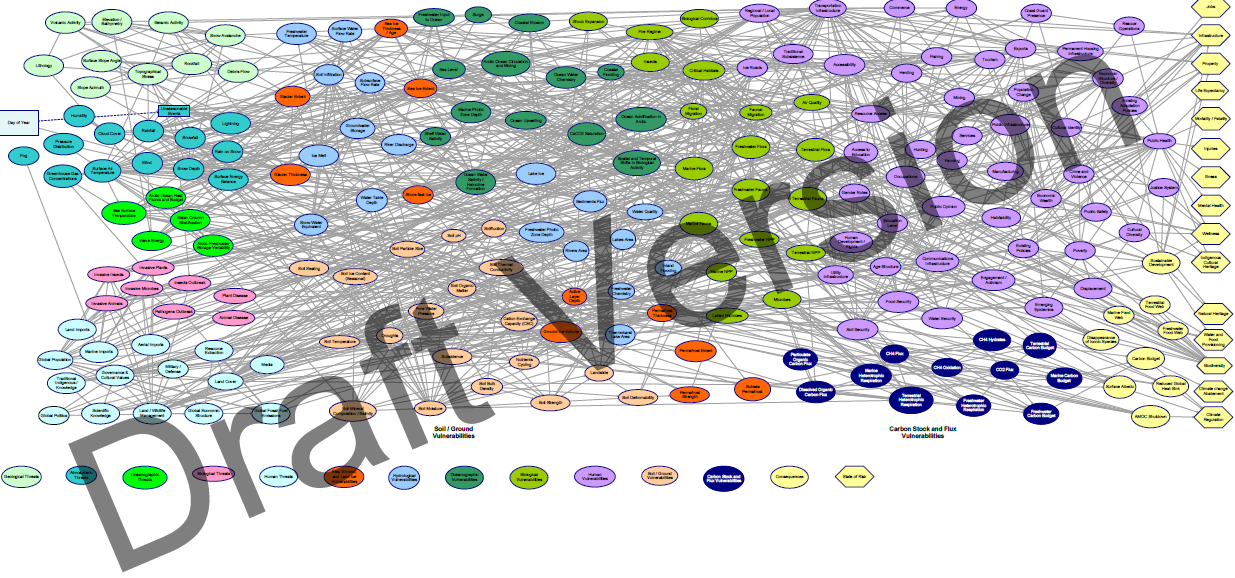
This effort started in 2018 and has evolved in the development of an Arctic Bayesian Model Framework set by Dr. Medina-Cetina to map:
- The states of Risk of spatio-temporal processes, associated to natural and anthropogenic threats- (atmospheric, geologic, oceanographic, biological, human)
- The systems and processes vulnerable to these threats (e.g. sea-ground-land ice, hydrological, biological, oceanographic, soil/ground, carbon stock)
- The likely social, economic and environmental consequences
After close to two-dozen expert workshops during a one-year period, experts identified 120 processes with the potential to integrate the first Risk Map for the Grand Arctic Ecosystem that can set sustainability policy across the countries integrating it.
The Arctic Bayesian Network shown below is a model that integrates Indigenous knowledge, scientific data, engineering assessments, and the expert opinion of governance bodies. The model is intended to illuminate the interconnectedness of the Arctic System and assess risk of natural and anthropogenic systems.
Click on the image to expand the model.
Risk Assessment & Management: Bayesian Framework
R = State of Risk
H = Hazard
V = Vulnerability
C = Consequence
AC = Active Countermeasures
PC = Passive Countermeasures

T = Threat Intensity
C = Value of Consequences
R = State of Risk

